Why Old Streets Bend Around What Came Before
Why old streets bend around what came before: read an unfamiliar map for clues to former boundaries, gathering places, terrain, and everyday routes.
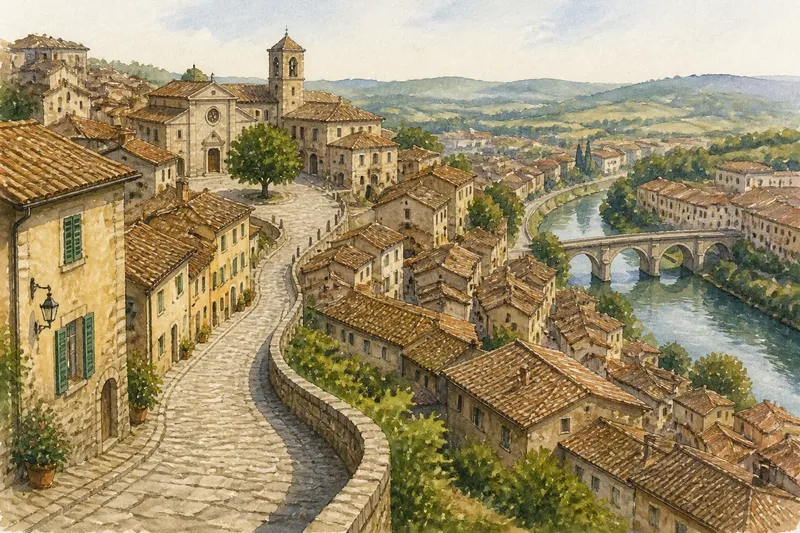
The most common mistake on an unfamiliar map is treating a crooked street as a failed attempt at a grid. That assumption can make a walk feel confusing and hide the useful clues a bend preserves. Old streets bend around what came before: a boundary, a well-used meeting place, a slope, or a route people already knew how to follow.
A street pattern is not a tidy diagram of a city’s past, and one curve cannot tell its whole story. But by noticing where streets turn, meet, narrow, or stop, you can form better questions about how a place grew—and then check those questions against what you see on foot.
Why do old streets bend instead of following a grid?
Old streets bend because many developed gradually around existing routes and obstacles, rather than being laid out all at once. A path to a water source, a property line, a hillside, or a busy entrance could shape later streets as buildings accumulated beside it.
A grid is easiest to impose when planners control a large, relatively open area. In an older center, land may already be divided, occupied, or difficult to cross. A new street then has to fit around what is there, or follow the route residents and traders already use. Repeated adjustments can leave a network of turns that looks irregular on a modern map but made sense to people moving through it.
That does not mean every crooked street is ancient or that every straight one is new. Some older routes were later widened or straightened; some modern streets curve to follow terrain or development. Treat the shape as a clue, not a date stamp.
What can a street pattern reveal about an older boundary?
A line of streets that curves around a district may trace an old edge: a wall, a fence, a property division, a religious enclosure, or a boundary between communities. The boundary itself may have disappeared while the street still follows its outline.
Look for several clues lining up. A curved street may run beside a cluster of smaller lanes, while the streets beyond it follow a different direction. A change in street names, building scale, or block shape can add context. None of these signs proves what the former boundary was, but together they can point toward a useful question: what area needed a distinct edge here?
On foot, notice whether passages seem to lead inward toward a shared center, or whether a broad street keeps circling an older cluster. A map can reveal the geometry; a walk can show whether the boundary still feels present in entrances, walls, or changes in how the street is used.
How can a former center survive after its purpose changes?
A former center can remain visible in the routes that converge on it, even after its original role has faded. A square may once have served a civic or trading function; a well, bridge approach, place of worship, or gate may have drawn foot traffic. Paths that met there can persist long after the reason for meeting changes.
On a map, look for several streets pointing toward a small open space or a cluster of public buildings. Then notice whether a nearby main road curves around that cluster instead of cutting through it. The arrangement may suggest an older focal point that later growth accommodated rather than replaced.
Names and buildings can help, but they need careful reading. A plaza called “Market Square” may preserve a memory, a later name, or simply a convention. A church or civic building can anchor a district without explaining when surrounding lanes formed. Use these details to guide observation, not to settle the story by themselves.
How do hills, water, and crossings shape the bends?
Terrain often leaves a street pattern that responds to practical movement. Roads may curve along a slope, avoid a steep rise, or climb by a gentler route. Near water, streets can follow a bank, funnel toward a bridge, or turn where a crossing once made a natural meeting point.
Compare the map with the land as you walk. A street that looks oddly indirect may offer a gradual climb where a straighter route would be steep. A bend near a river may lead toward a bridge or an old crossing point, even if the river has since been contained or covered. On a hillside, watch for lanes that run across the slope and smaller paths that climb between them.
Imagine you have reached a hillside town and a lane curves around a steep rise before meeting a bridge approach. The map suggests two possible influences: the slope and the crossing. If the lane climbs gradually and the surrounding streets gather near the bridge, you can record both observations without deciding which came first.
How can you read a crooked street without overclaiming?
Start with what you can see, then separate observation from interpretation. “This lane curves around a cluster of narrow streets” is an observation; “it follows a former wall” is a theory. Keeping the two distinct makes your reading more accurate and your notes more useful.
- Mark where the street changes direction, meets another route, or ends.
- Look for a nearby open space, watercourse, steep slope, or enclosed block.
- Notice whether several streets share the same curve or approach the same center.
- Compare the map with entrances, walls, steps, and changes in street level on foot.
- Write down at least one alternative explanation before settling on a likely one.
Say you spot a crescent-shaped lane beside a small square. You note that the lane curves around the square and that several side streets point toward it; you then check whether the ground rises or whether a large enclosure borders the opposite side. The expected result is not a final verdict, but a more grounded account of what the street arrangement may reflect.
What is not worth the effort is assigning an ancient origin to every irregular corner. A complicated theory can distract from simple visible explanations, such as a slope or a property edge that remains in use.
What should you ask while looking at an unfamiliar map?
Does a bend always mark an old wall?
No. A bend can follow a boundary, but it can also reflect terrain, a watercourse, a later road plan, or the way buildings developed. Look for supporting clues before naming the feature it may once have followed.
Why do several narrow streets meet near one point?
They may converge on a former center, a crossing, an entrance, or a convenient route through the district. Check whether an open space or a change in the street pattern sits at that meeting point.
Can a straight street be part of an old street pattern?
Yes. Older networks can include straight routes, and later changes can straighten an existing street. Shape alone cannot reliably tell you a street’s age.
What if the map does not explain the bend?
Leave the question open and pay attention to what the street does on the ground. A change in slope, a blocked passage, or a route toward a bridge may offer context that the map does not show.
How can a street pattern guide a curious walk?
Let the map suggest a question, then follow the street far enough to notice how it behaves. If it curves around a square, look at the approaches; if it turns beside a steep slope, notice whether the grade eases; if several lanes point toward a crossing, see how people move between them. The point is not to turn every walk into a puzzle, but to notice how routes make room for older arrangements.
When you describe an old street, say what its shape makes you wonder about and what you observed that supports the idea. That small distinction keeps a travel note honest while giving it a sense of place. Old streets bend around what came before, but the most useful map-reading habit is to stay curious about what that “before” might have been.